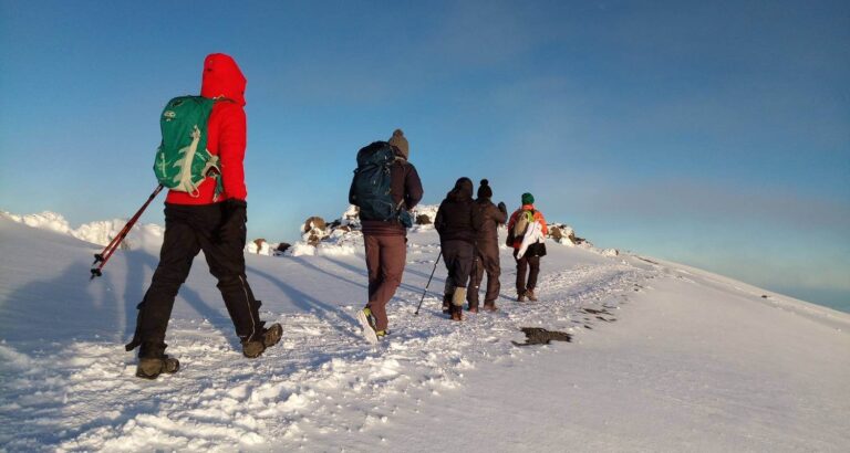
The Kilimanjaro climb 7 days lemosho is the best for acclimatization. The route is less used and beautiful way up to the Shira Plateau.The minimum duration for the Lemosho route is 6 days, however we strongly recommend hiking the route in 7 days.
The additional 7th day will give your body more time to acclimatize, reducing the effects of altitude sickness and give you more time to rest before attempting the summitA landscape shot of Mt Kilimanjaro with the famous elephants of Amboseli
BOOK THIS TOUR
Customize your Trip
Create unforgettable memories as you explore the heart of Africa. Book your adventure today!”
Day 1: Drive to Kilimanjaro National Park Londorossi Gate, Hike to Mti Mkubwa Camp
Elevation: 1830m/6000ft to 2650m/8700ft Distance: 6km/4mi Hiking Time: 2-3 hours Habitat: Montane Forest Budget Lodging: Mti Mkubwa Camp.
After breakfast and briefing, drive to Londorossi Park Gate (about a 3-hour drive). From here a forest track requiring a 4WD vehicle leads to Lemosho Glades. Walk along forest trails to Mti Mkubwa (big tree) campsite.
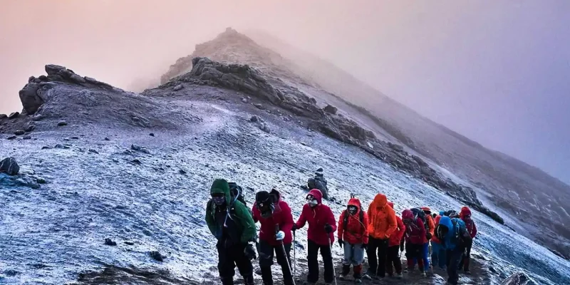
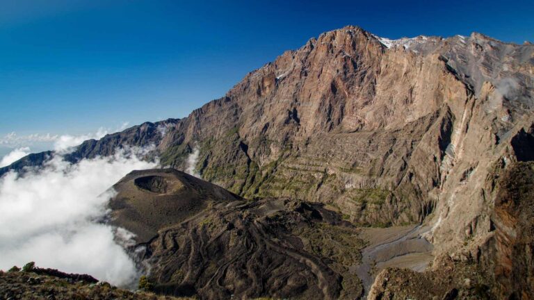
From the Shira Plateau we continue to the east up a ridge, passing the junction towards the peak of Kibo. As we continue, our direction changes to the South East towards the Lava Tower, called the “Shark’s Tooth” (elevation 4650m/15,250ft).
Shortly after the tower we come to the second junction, which goes to the Arrow Glacier. We now continue down to the Barranco Camp. Although you end the day around the same elevation, as when you began, this day is very important for acclimatization and will help your body prepare for summit day.
We continue up to the Barafu Camp. South Circuit will be completed, which offers views of the summit from many different angles. Here we make camp, rest, enjoy dinner, and prepare for the summit day.
Meals: BLD
Day 5: Hike Mawenzi Tarn to Kibo Hut
Elevation: 4330m/14,200ft to 4750m/15,600ft Distance: 9km/5miles Hiking Time: 4-5 hours Habitat: Alpine Desert Budget Lodging: Kibo Hut Camp.
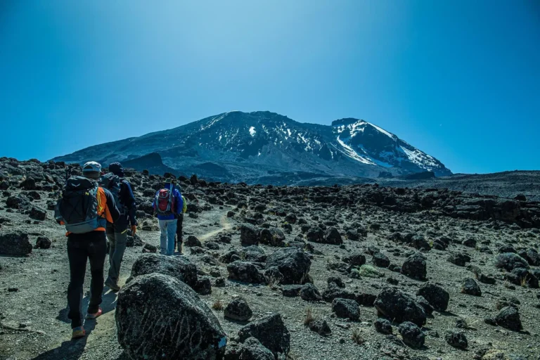
Cross the lunar desert of the ‘Saddle’ between Mawenzi and Kibo to reach Kibo campsite at the bottom of the Kibo crater wall. The remained day will be spent resting in preparation for the final ascent early in the morning.
Meals: BLD
Day 6: Hike Barafu Camp to Summit, down to Mweka Camp
Elevation: 4700m/15,350ft to 5895m/19,340ft Down to 3090m/10,150ft Distance: 5km/3mi up / 13km/8mi down Hiking Time: 5-7 hours up / 5-6 hours down Habitat: Stone scree and ice-capped summit Budget Lodging: Mweka Camp.
Very early in the morning, we will continue our way to the summit between the Rebmann and Ratzel glaciers. You will head in a northwesterly direction and ascend through heavy scree towards Stella Point on the crater rim. This is the most challenging portion of the trek.
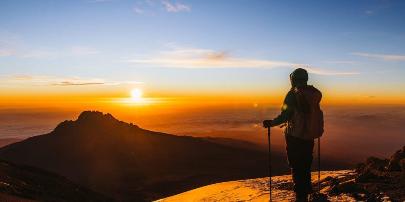
At Stella Point you will have a short rest while being rewarded with magnificent sunrise ever seen before. Faster hikers may view the sunrise from the summit. From Stella Point, you may encounter snow all the way on your 1-hour ascent to the summit (Uhuru Peak) the highest point on Mount Kilimanjaro.
From the summit we begin our descent by continuing straight down to the Mweka Camp, stopping at Barafu for lunch. You may want gaiters and trekking poles for the loose gravel going down. We arrive at Mweka Camp and enjoy our last evening on the mountain.
Meals: BLD
Day 7: Hike Mweka Camp to Mweka Gate, drive to Moshi
After breakfast we will descent down to the Mweka Park Gate to receive your summit certificates. At lower elevations, it can be wet and muddy. Gaiters and trekking poles will help. Shorts and t-shirts will probably be plenty to wear (keep rain gear and warmer clothing handy).
From the gate, continue another hour to Mweka Village. A vehicle will meet you at Mweka village to drive you back to your hotel in Moshi (about 30 minutes). Don’t forget to tip your guides and porters.
Meals: B
TOUR INCLUDES
Professional Guides and Porters
Park Entry Fees
Camping Equipment
Meals and Drinking Water
First Aid Kit
Safety Measures
Rescue Services and emergency evacuation services, where applicable, for high-altitude treks like Kilimanjaro.
TOUR EXCLUDES
International or Local Flights
Vaccinations/Medical Tests
Meals Not Specified
Alcoholic and soft drinks
Visa fees
Tips
Personal spending money for souvenirs etc.
Travel insurance
Related Trekking
5 Days | 4 Nights
Marangu Route
Marangu route is rightfully popular amongst Kilimanjaro
5 Days | 4 Nights
Mount Meru
The trek starts from Momella Gate and passes through lush forests
8 Days | 7 Nights
Lemosho Route
The Kilimanjaro climb 8 days lemosho is the best for acclimatization. The remote..